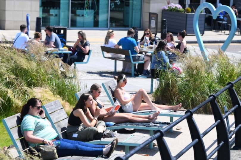
UK SET TO SIZZLE IN 27C HEATWAVE WITH 'LAST HURRAH' OF SUMMER SWEEPING ENGLAND
The UK faces a final heatwave of 2024 in a "last hurrah". The UK will bask in glorious highs as temperatures skyrocket as we head deeper into September and away from the meteorological summer, amid hopes of an Indian Summer.
The heat will remain in the high 20s for most of this weekend, according to the independent weather forecasting service Netweather. "This warm air will bring a lot of low cloud and murk in from the North Sea so don’t assume that it will be sunny," says Jo Farrow, a senior forecaster at Netweather.
"Where it is, it will be glorious with light winds in the north." Netweather TV went on and explained: "Southern Britain looks most at risk of rain after bands of wet weather lurk in the English Channel on Thursday and Friday."
READ MORE Martin Lewis warns drivers of these three cars to 'decide now' or lose £2,100
Maps and charts from WX Charts, which use Met Desk data, show the mercury rising to 27C at times. Netweather said: "At the weekend, to the north of this unsettled weather, there will be the chance of fine weather and warmth but it could be subdued by low cloud and even damp conditions off the North Sea."
Speaking previously, James Madden said we should start to see a return of "prolonged summery weather from significant high pressure rises". The Exacta Weather forecaster said: "This will initially see temperatures climbing and ranging into the mid to high-20Cs, at the very least quite widely to begin with.
"However, the expected heat surges are now highly likely to be significant throughout late August and well into September, and there is no reason as to why we couldn't see further extreme temperatures in at least the low to mid-30Cs during these developments."
The Met Office forecast from September 9 onwards explains: "There remains a chance of heavy rain in parts of the south and east at the start of next week before this area moves away over the continent. However, conditions will remain generally unsettled during next week with showers or longer spells of rain at times for all regions.
"Winds will often be from the north or northwest, resulting in cooler conditions become established nationwide. Some spells of windy weather are possible too. Most regions will still see some drier weather at times but this unlikely to be prolonged. Unsettled conditions are then most likely to persist through the middle of September with spells of wet and windy weather for all areas. Temperatures likely varying around average after a cool spell during next week."
2024-09-05T08:13:46Z dg43tfdfdgfd